16640180
Descripción
Fichas por Salo Rivera, actualizado hace más de 1 año
|
|
Creado por Salo Rivera
hace casi 6 años
|
|
| Pregunta | Respuesta |
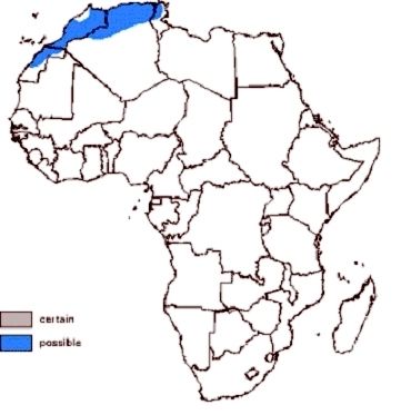
| Atlas Mountains | A high mountain range in northwestern Africa. In three countries: Morocco. Algeria and Tunisia. |
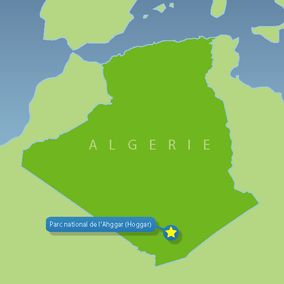
| Mt. Tahat | Highest peak in the Hoggar Mountains (Ahaggar Mountains). In Southern Algeria, along the Tropic of Cancer |
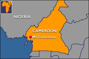
| Mt. Cameroon | An active volcano in Cameroon near the Gulf of Guinea. Highest point in sub-Saharan West African and Central Africa. |
| Ahaggar Mountains | Mountain range located in southern Algeria. In Southern Algeria, along the Tropic of Cancer. |
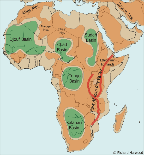
| Ethiopian Highlands | Most of the Ethiopian Highlands are part of central and northern Ethiopia, and its northernmost portion reaches into Eritrea. |
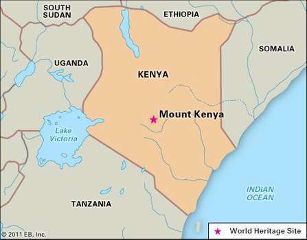
| Mt. Kenya | Second highest peak in Africa; located in Kenya. Mount Kenya is located in the former Eastern and central provinces of Kenya. |
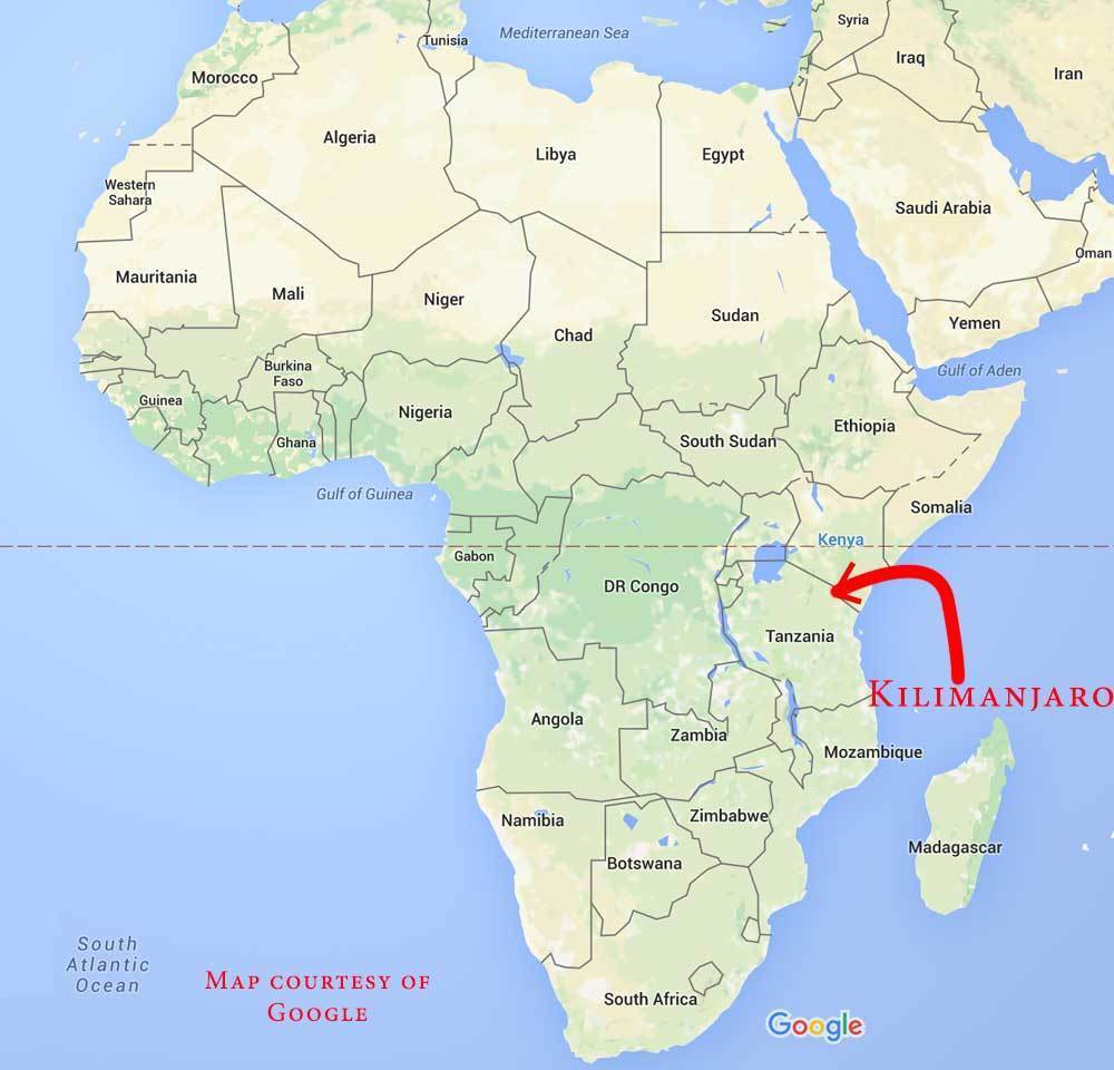
| Mt. Kilimanjaro | Africa's highest mountain in Tanzania; also a volcano with its three volcanic cones, "Kibo", "Mawenzi", and "Shira" |
| Muchinga Mountains | This is a mountain range located in northeastern Zambia. It is situated to the east of Lake Bangweulu, and is home to the source of the Luangwa River. This mountain range divides the Congo and Zambezi Basins. |
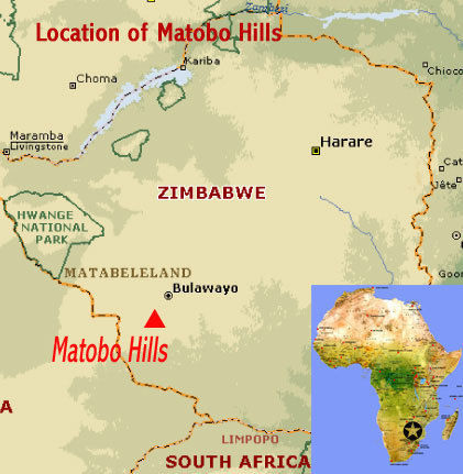
| Matopo Hills |
The Matobo Hills cultural landscape is located in southern Zimbabwe
Image:
Matopo (binary/octet-stream)
|
| Drakensberg Mountains | The Drakensberg is part of the Great Escarpment and separates the extensive high plateaus of the South African interior from the lower lands along the coast. |
| Bié Plateau | Bié Plateau The Bié Plateau or Central Plateau of Angola is a plateau that occupies most of central Angola. |
| Katanga Plateau | The Katanga, or Shaba, Plateau is a farming and ranching region in the Democratic Republic of the Congo. |
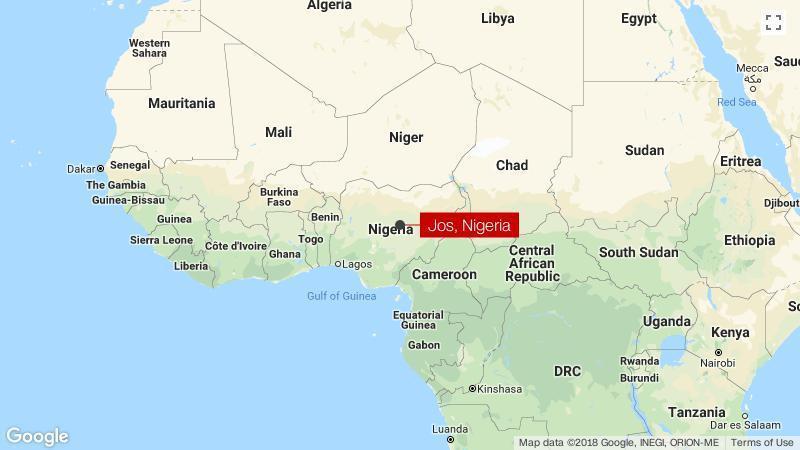
| Jos Plateau | The Jos Plateau is a plateau located near the centre of Nigeria. |
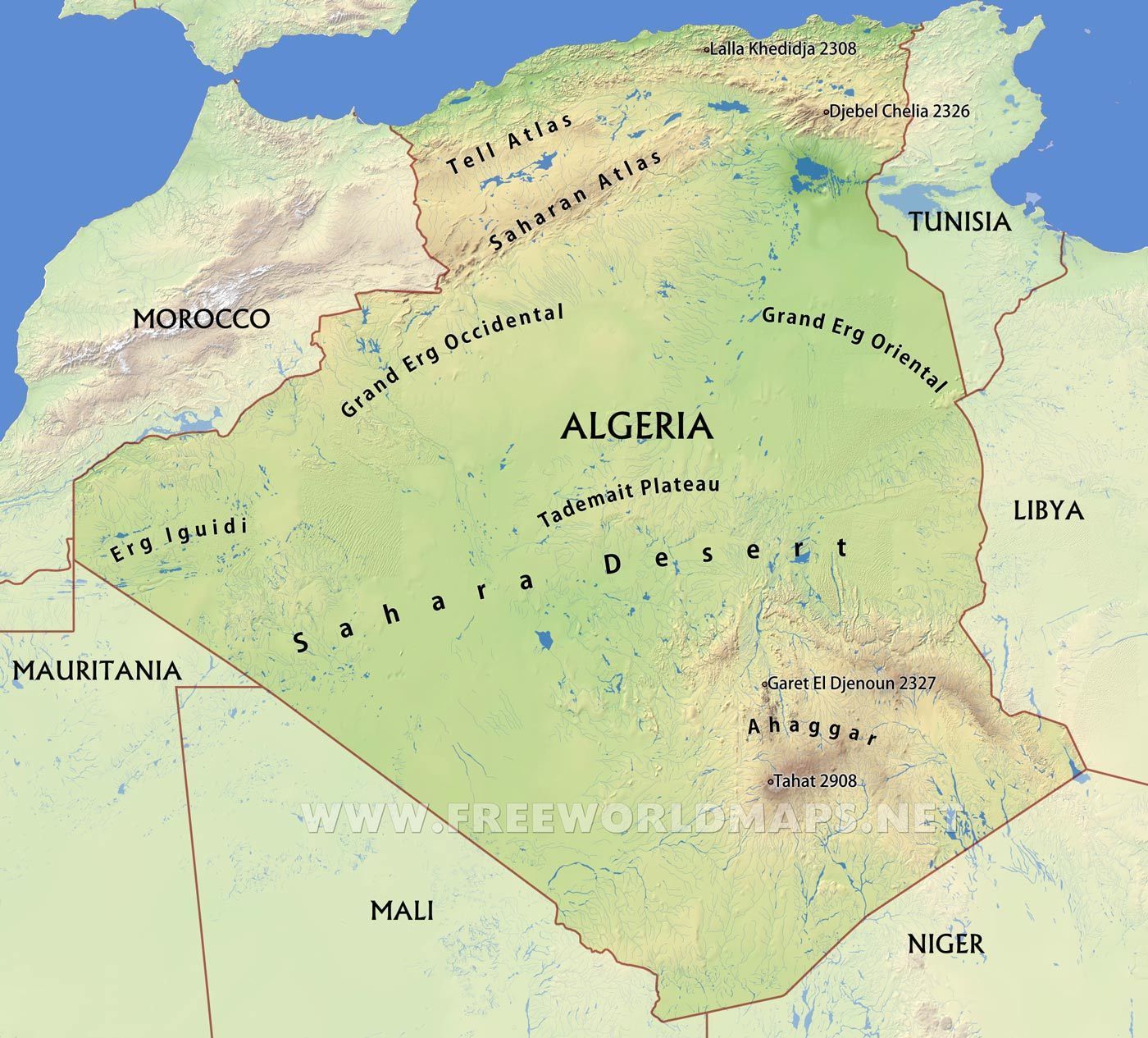
| Tademaït Plateau | Tademaït is a natural region in the Sahara Desert right in the centre of Algeria. |
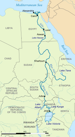
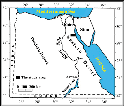
| Nile River |
The Nile river as its drainage basin covers eleven countries, namely, Tanzania, Uganda, Rwanda, Burundi, the Democratic Republic of the Congo, Kenya, Ethiopia, Eritrea, South Sudan, Republic of the Sudan and Egypt.
Image:
N Ile (binary/octet-stream)
|
| White Nile River | This is the bigger part of the Nile River. Section of the Nile between Malakal, South Sudan, and Khartoum, Sudan. |
| Blue Nile River | The Blue Nile is a river originating at Lake Tana in Ethiopia. |
| Congo River |
Congo River, formerly Zaire River, river in west-central Africa.
Image:
Congo (binary/octet-stream)
|
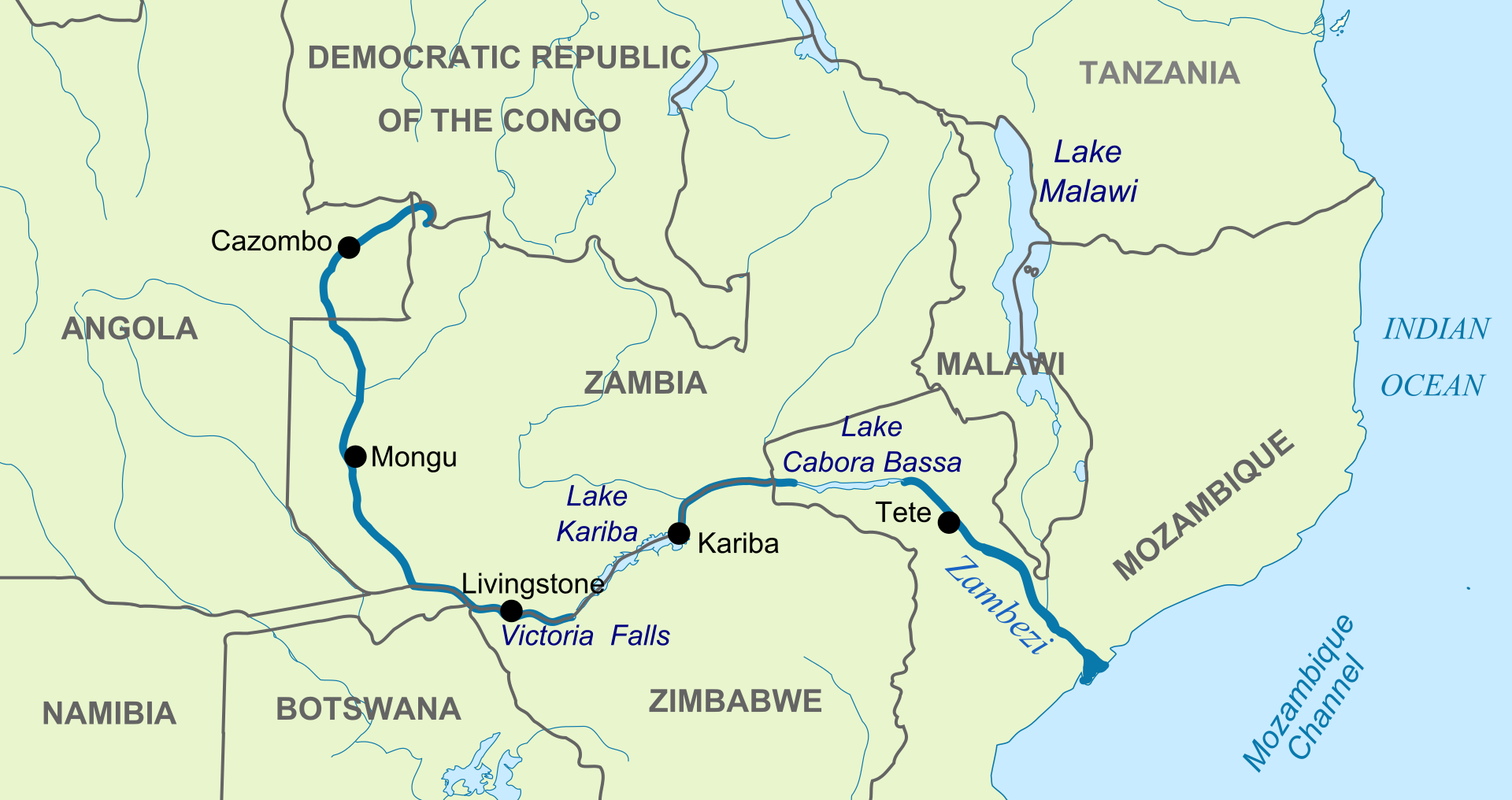
| Zambezi River | Rises in Zambia and flows through eastern Angola, along the eastern border of Namibia and the northern border of Botswana, then along the border between Zambia and Zimbabwe to Mozambique, where it crosses the country to empty into the Indian Ocean. |
| Black Volta River |
The Black Volta or Mouhoun is a river that flows through Burkina Faso flowing to the White Volta in Dagbon, Ghana. The Black Volta forms part of the border between Ghana and Côte d'Ivoire and Burkina Faso.
Image:
Volta (binary/octet-stream)
|
| White Volta |
The White Volta or Nakanbé is the headstream of the Volta River, Ghana's main waterway. The White Volta emerges in northern Burkina Faso, flows through North Ghana and empties into Lake Volta in Ghana.
Image:
Volta (binary/octet-stream)
|
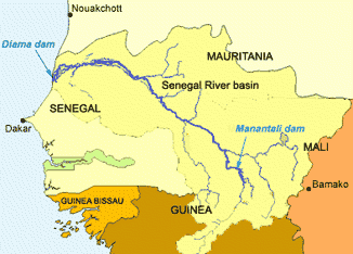
| Senegal River | The Senegal River is a long river in West Africa that forms the border between Senegal and Mauritania. |
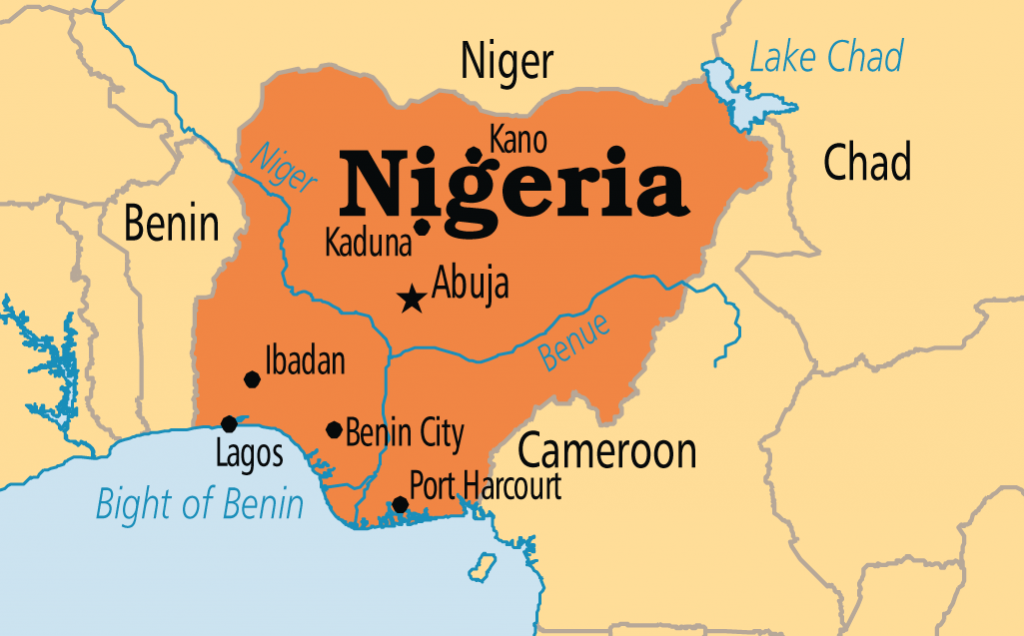
| Benue Rive |
The Benue River is the major tributary of the Niger River.
Image:
Benue (binary/octet-stream)
|
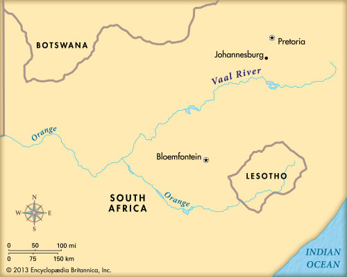
| Vaal River |
The Vaal River is the largest tributary of the Orange River in South Africa.
Image:
Vaal (binary/octet-stream)
|
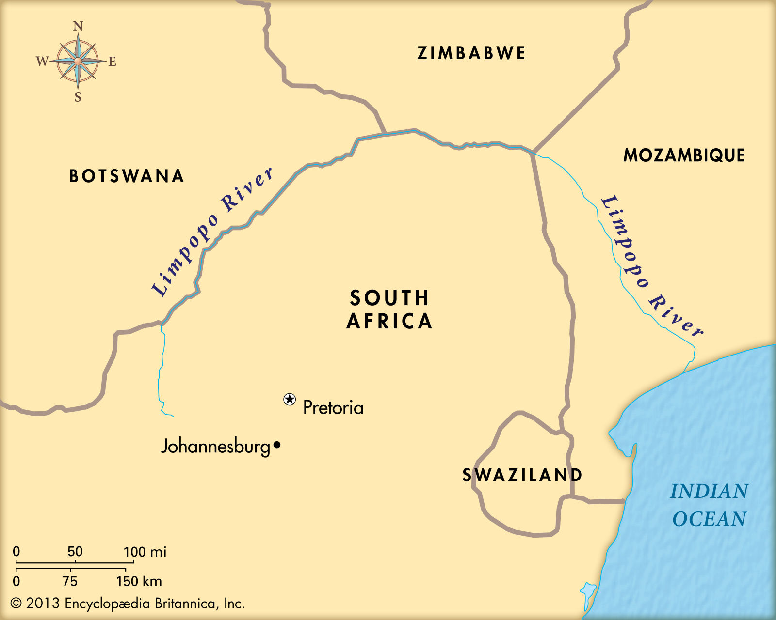
| Limpopo River | The Limpopo River rises in South Africa, and flows generally eastwards to the Indian Ocean in Mozambique. |
| Victoria Falls | Victoria Falls is located on the Zambezi River, the fourth largest river in Africa, which is also defining the border between Zambia and Zimbabwe. |
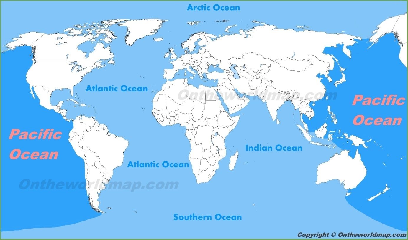
| Pacific Ocean | |
| Atlantic Ocean | |
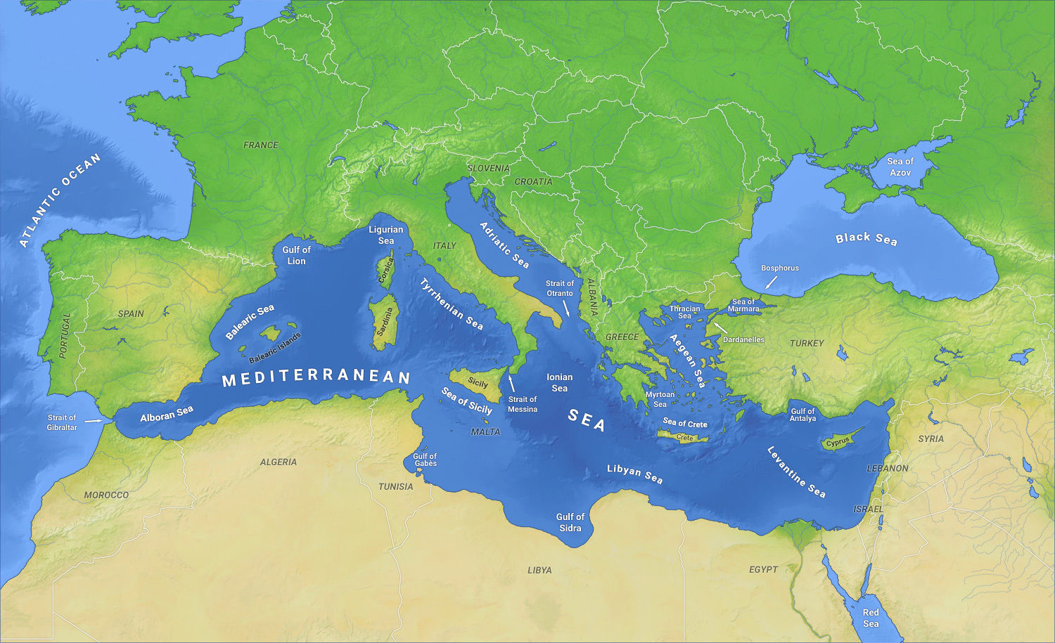
| Mediterranean Sea | |
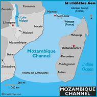
| Mozambique Channel | he Mozambique Channel is an arm of the Indian Ocean located between the Southeast African countries of Madagascar and Mozambique. |
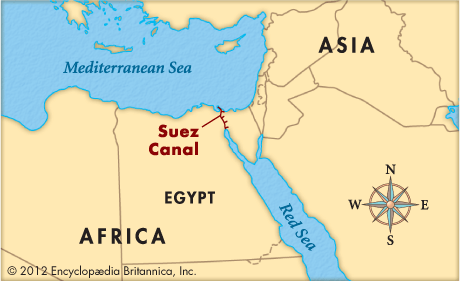
| Suez Canal | The Suez Canal is a sea-level waterway in Egypt, connecting the Mediterranean Sea to the Red Sea through the Isthmus of Suez. |
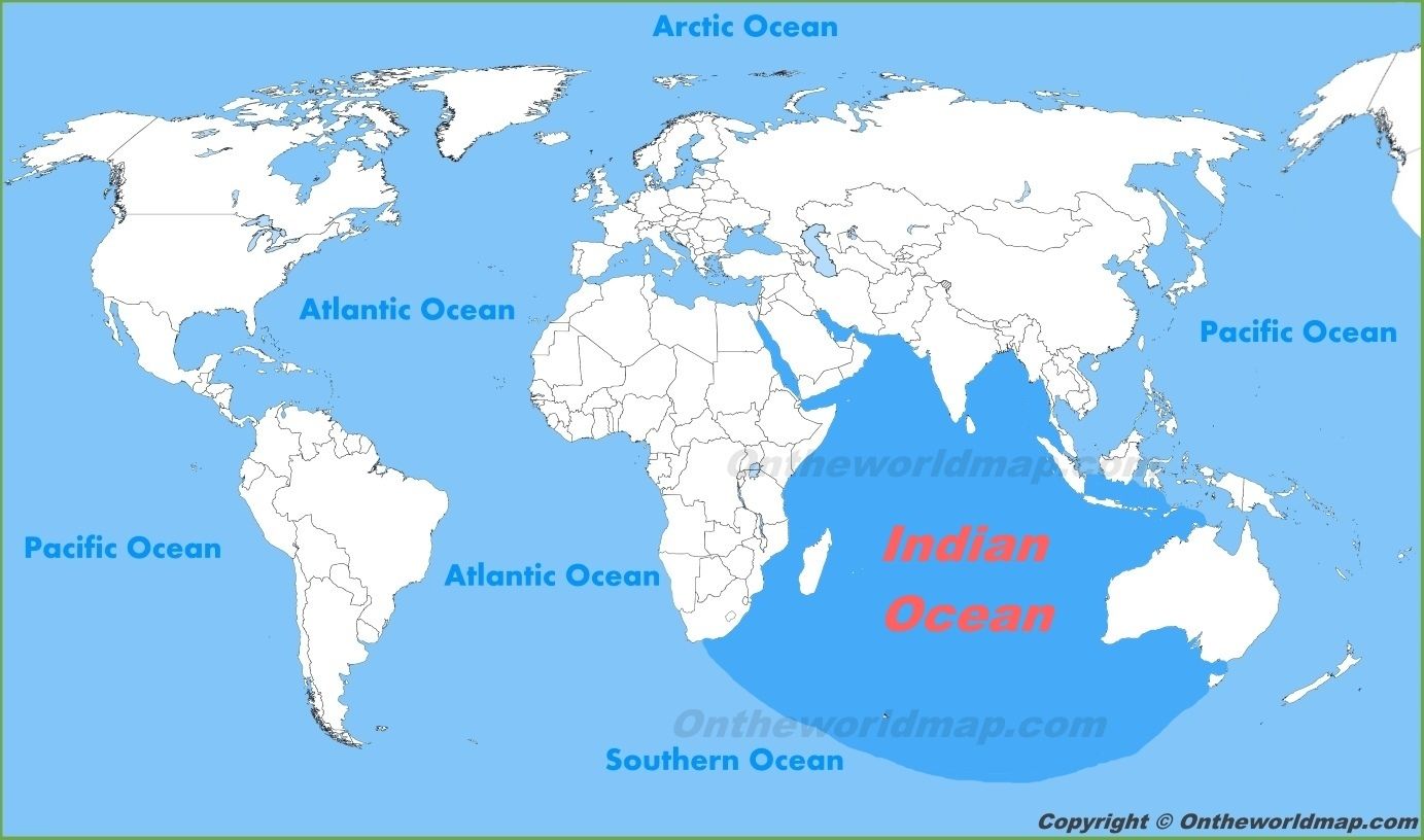
| Indian Ocean | |
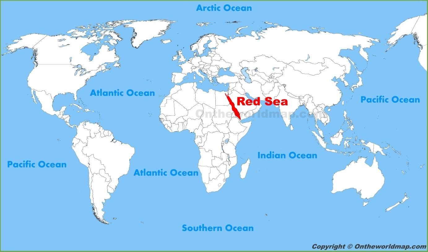
| Red Sea |
Between Africa and Asia
Image:
Redsea (binary/octet-stream)
|
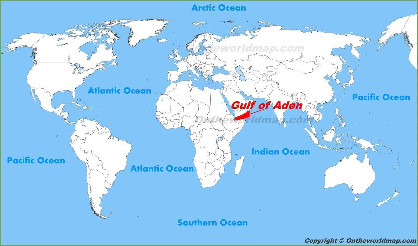
| Gulf of Aden | Yemen to the North and Somalia to the South. |
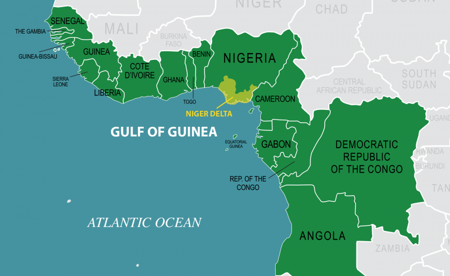
| Gulf of Guinea | The Gulf of Guinea is the northeastern-most part of the tropical Atlantic Ocean. |
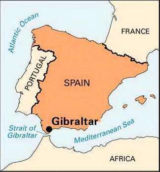
| Strait of Gibraltar | The Strait of Gibraltar is a narrow strait that connects the Atlantic Ocean to the Mediterranean Sea and separates Gibraltar and Peninsular Spain in Europe from Morocco and Ceuta (Spain) in Africa. |
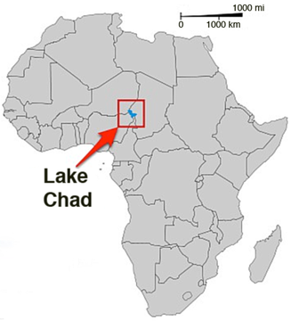
| Lake Chad | a historically large, shallow, lake in Africa, which has varied in size over the centuries. Has four countries surrounding it (Chad, Cameroon, Niger, and Nigeria) on the edge of the Sahara. |
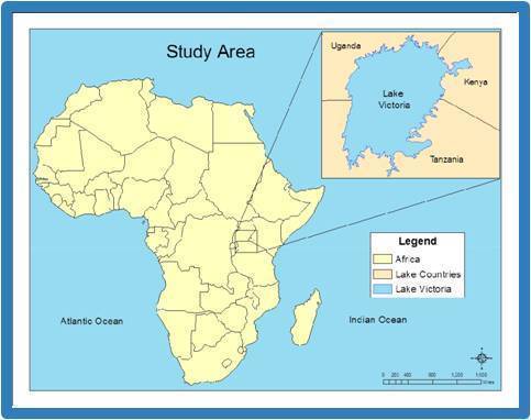
| Lake Victoria | Surrounded by Kenya, Uganda and Tanzania. |
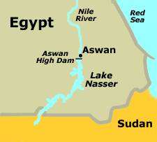
| Lake Nasser | Lake Nasser is a vast reservoir in southern Egypt and northern Sudan. |
| Lake Volta |
Within the country of Ghana.
Image:
Volta (binary/octet-stream)
|
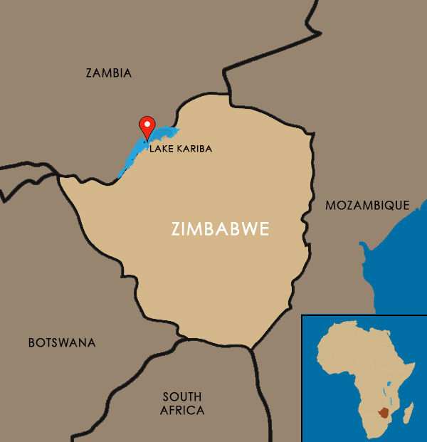
| Lake Kariba | Upstream from the Indian Ocean, along the border between Zambia and Zimbabwe. |
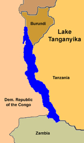
| Lake Tanganyika | The lake is divided among four countries – Tanzania, Democratic Republic of the Congo (DRC), Burundi, and Zambia |
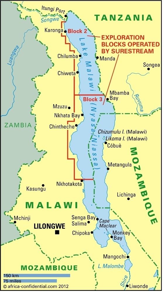
| Lake Malawi | An African Great Lake and the southernmost lake in the East African Rift system, located between Malawi, Mozambique and Tanzania. |
| Lake Nyasa | Also known as Lake Malawi |
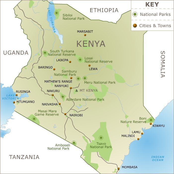
| Lake Turkana | A lake in the Kenyan Rift Valley, in northern Kenya, with its far northern end crossing into Ethiopia. |
| Lake Albert | A lake located in Uganda and the Democratic Republic of the Congo. It is one of the African Great Lakes. |
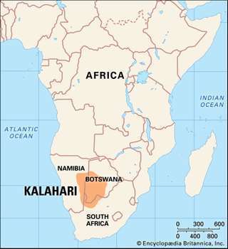
| Kalahari Desert | A large semi-arid sandy savanna in Southern Africa covering much of Botswana, parts of Namibia and regions of South Africa. |
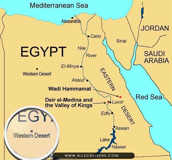
| Western Desert | The Western Desert of Egypt is an area of the Sahara which lies west of the river Nile, up to the Libyan border, and south from the Mediterranean sea to the border with Sudan. |
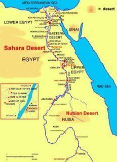
| Nubian Desert | As in the eastern region of the Sahara Desert, spanning approximately northeastern Sudan and northern Eritrea, between the Nile and the Red Sea. |
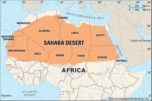
| Sahara Desert | |
| Eastern Desert | The Eastern Desert is the part of the Sahara desert that is located east of the Nile river, between the river and the Red Sea |
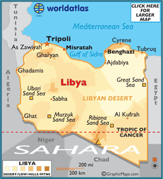
| Libyan Desert | The Libyan Desert forms the northern and eastern part of the Sahara Desert. It describes that part of the Sahara that lies within the present-day state of Libya. |
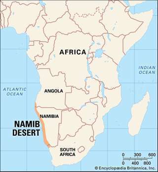
| Namib Desert | The Namib is a coastal desert in southern Africa. |
| El Djouf | El Djouf is a desert, an arid natural region of sand dunes and rock salt which covers northeastern Mauritania and part of northwestern Mali. |
¿Quieres crear tus propias Fichas gratiscon GoConqr? Más información.