
17805690
Description
Flashcards by Ainhoa Garcia Felipez, updated more than 1 year ago

|
|
Created by Ainhoa Garcia Felipez
almost 6 years ago
|
|
| Question | Answer |
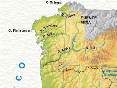
| Es un mapa físico de Galicia, ya que representa las características físicas de la superficie terrestre | |
|
Image:
España (binary/octet-stream)
|
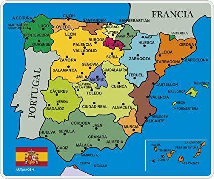
Es un mapa político de España, ya que indica los límites de unidades territoriales, en este caso, las CCAA |
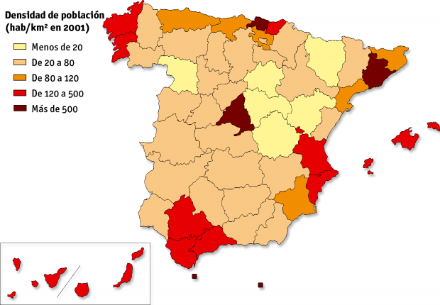
| Es un mapa temático ya que representa algún fenómeno, en este caso la población en España. | |
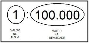
| Escala numérica: 1 cm en el mapa corresponde con 100.000 cm en la realidad | |
|
Image:
1 3 (binary/octet-stream)
|
Escala gráfica: 1 cm en el mapa equivale a 250 m en la realidad. |
0 comments
Want to create your own Flashcards for free with GoConqr? Learn more.