10862962
Description
Mind Map by Benito Román Guerrero Blanco, updated more than 1 year ago
|
|
Created by Benito Román Guerrero Blanco
about 8 years ago
|
|
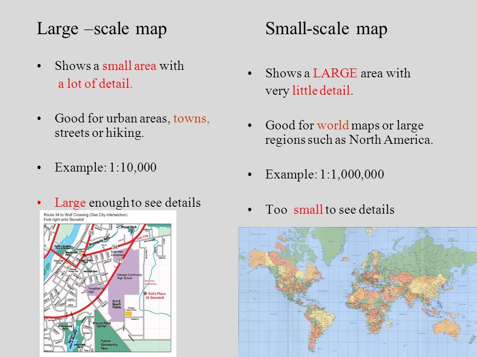
1.5 HOW DO WE USE SCALE ON A MAP?
- MAP SCALE
- a map is a reduced
representation of a real
area.
- MAP SCALE is the relationship (or ratio) between distance on
a map and the corresponding distance in the real ground.
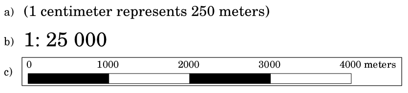
- NUMERIC OR RATIO SCALE is expressed as a fraction (i.e.
E:1/200,000 or E:1:200,000. It means that 1 cm on the map
represents 200,000 cm on the real ground or 2,000m or 2km)
- GRAPHIC SCALE (LINEAR OR BAR SCALE) shows the
equivalent distance on a bar divided into equal segments,
usually 1cm. Each piece or segment of the bar represents a
given distance, as labelled.
- a map is a reduced
representation of a real
area.
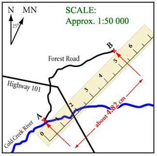
- HOW TO USE SCALE TO
CALCULATE DISTANCES
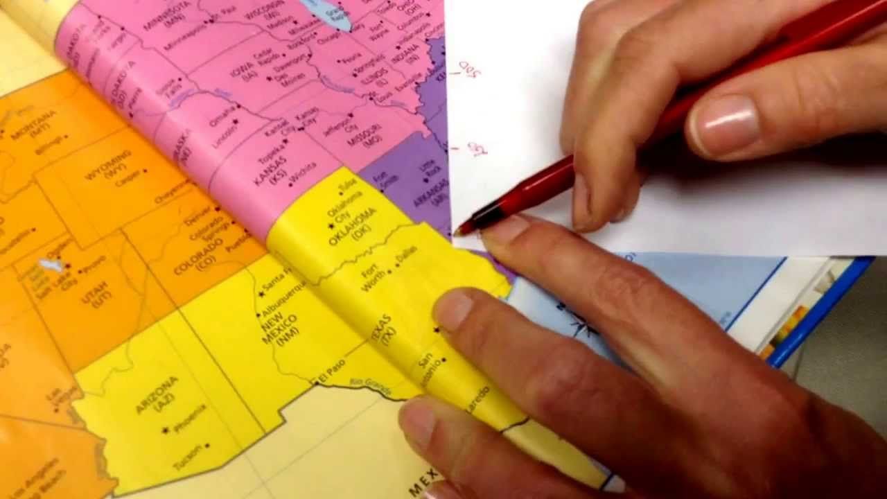
- USING NUMERIC SCALE
- 1. First we change numeric scale (i.e. E:1:11900000 >
1cm in the map is 11900000 cm or 119000m or 119 km in
the real world ).
- 2. Then we have to measure in centimetres with a ruler
the distance we wish to calculate (i.e. 6 cm)
- 3. Finally we do the calculations: 6 x 119 km = 714 km
- 1. First we change numeric scale (i.e. E:1:11900000 >
1cm in the map is 11900000 cm or 119000m or 119 km in
the real world ).
- USING GRAPHIC SCALE
- 1. First we measure how long one segment of the graphic
scale is on your ruler (i.e. 16 cm on the bar is 5000 km).
- 2. Then we have to measure with a ruler the distance
we wish to calculate in centimetres (i.e. 8 cm)
- 3. Finally we do the calculations: divide the total
distance measured by the length of one segment of the
scale (8:16=0,5 segments) > 0,5x 5000km= 2,500km
- OTHER FORM: we can use a piece of paper down on the
map and mark it with the distance we wish to calculate
or with the segments of the bar.
- 1. First we measure how long one segment of the graphic
scale is on your ruler (i.e. 16 cm on the bar is 5000 km).
- USING NUMERIC SCALE
Media attachments
Want to create your own Mind Maps for free with GoConqr? Learn more.