1710166
Pregunta 1
Pregunta
What is Geography?
Respuesta
-
The study of location and place.
-
The study of animals.
-
It is only about maps.
-
It is the study of people and why they live where they do.
Pregunta 2
Pregunta
What are the two Geography Disciplines?
Respuesta
-
Human and Physical
-
Landforms and Ecology
-
Geology and Physical
-
GIS and GPS
Pregunta 3
Pregunta
Which of the following is NOT an area of study for Human Geography?
Respuesta
-
Landforms
-
Immigration
-
Population
-
Rock Cycle
Pregunta 4
Pregunta
Which of the following is NOT an area of Physical Geography?
Respuesta
-
Maps
-
Plate Tectonics
-
Sustainability
-
Climate
Pregunta 5
Pregunta
What is a map?
Respuesta
-
A representation of Earth's features on a flat surface.
-
A very complicated colour drawing.
-
Satellites in space provide locational information.
-
A drawing with a lot of details and has a scale.
Pregunta 6
Pregunta
What are the six map requirements?
Respuesta
-
Title, Legend, Scale, Date, Direction, and Border
-
Title, Scale, Distance, Compass Ross, Date and Border
-
Title, Distance, Instructions, Directions, Scale and Border
-
Title, Scale, Distance, Legend, Compass Rose and Border
Pregunta 7
Pregunta
What is a Large Scale Map?
Respuesta
-
A map that shows a large amount of detail in a small area.
-
A map that shows a small amount of detail in a large area.
-
A map that shows a large amount of detail in a large area.
-
A map that shows a small amount of detail in a small area.
Pregunta 8
Pregunta
What is an example of a Large Scale Map?
Respuesta
-
A map of the world.
-
A map used for hiking.
-
A map found in an atlas.
-
A map that shows Europe.
Pregunta 9
Pregunta
What scale would a large scale map typically have?
Respuesta
-
1:25,000
-
1:250,000
-
1:2,500,000
-
1:250,00,000
Pregunta 10
Pregunta
What is a small Scale Map?
Respuesta
-
A map that shows a large amount of detail in a small area.
-
A map that shows a small amount of detail in a large area.
-
A map that shows a large amount of detail in a large area.
-
A map that shows a small amount of detail in a small area.
Pregunta 11
Pregunta
What is an example of a small scale map?
Respuesta
-
A map for hiking.
-
A map of the Appleby Campus.
-
A map of the world.
-
A map used in a shopping mall.
Pregunta 12
Pregunta
What scale would a small scale map typically have?
Respuesta
-
1:25,000
-
1:15,000
-
1:2,500,000
-
1:30,000
Pregunta 13
Pregunta
A General purpose map
Respuesta
-
contains many types of information on one map
-
contains information on only one topic or theme
-
large-scale map showing both natural and human-made features.
-
the location of geographic data is digitized, placed in databases, and used in various combinations to create maps.
Pregunta 14
Pregunta
A Thematic Map
Respuesta
-
contains many types of information on one map
-
contains information on only one topic or theme
-
large-scale map showing both natural and human-made features.
-
the location of geographic data is digitized, placed in databases, and used in various combinations to create maps.
Pregunta 15
Pregunta
A Topographic Map
Respuesta
-
contains many types of information on one map
-
contains information on only one topic or theme
-
large-scale map showing both natural and human-made features.
-
the location of geographic data is digitized, placed in databases, and used in various combinations to create maps.
Pregunta 16
Pregunta
A Digital Map
Respuesta
-
contains many types of information on one map
-
contains information on only one topic or theme
-
large-scale map showing both natural and human-made features.
-
the location of geographic data is digitized, placed in databases, and used in various combinations to create maps.
Pregunta 17
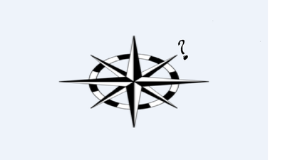
Respuesta
-
North East
-
South East
-
North West
-
South West
Pregunta 18
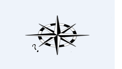
Respuesta
-
South East
-
North East
-
South West
-
North West
Pregunta 19
Pregunta
Which of the following is NOT a cardinal point?
Respuesta
-
North East
-
North
-
East
-
South
Pregunta 20
Pregunta
What direction is opposite of NE?
Respuesta
-
SW
-
NW
-
SE
-
S
Pregunta 21
Pregunta
What direction is the opposite of NNW?
Respuesta
-
SSE
-
NNE
-
SSW
-
ESE
Pregunta 22
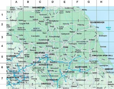
Respuesta
-
Alphanumeric
-
Military
-
General Purpose
-
Digital
Pregunta 23
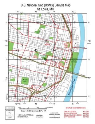
Respuesta
-
Alphanumeric
-
Military
-
General Purpose
-
Digital
Pregunta 24
Pregunta
What is true about an Easting?
Respuesta
-
The numbers of the vertical lines increase as you move west to east.
-
The numbers of the vertical lines decrease as you move west to east.
-
The numbers of the horizontal lines increase as you move south to north
-
The numbers of the horizontal lines decrease as you move south to north
Pregunta 25
Pregunta
What is true about a Northing?
Respuesta
-
The numbers of the horizontal lines increase as you move south to north.
-
The numbers of the horizontal lines decrease as you move south to north.
-
The numbers of the vertical lines increase as you move west to east.
-
The numbers of the vertical lines decrease as you move west to east.
Pregunta 26
Pregunta
The prime meridian runs through which place on Earth?
Respuesta
-
Greenwich
-
Ottawa
-
London
-
Paris
Pregunta 27
Pregunta
Which of the following statements about Lines of Latitude is FALSE?
Respuesta
-
Run east-west around the globe
-
Are parallel to the equator
-
Are located approximated 111 km apart
-
Run up to 90̊ north and 90̊ south
-
All of the above are correct.
Pregunta 28
Pregunta
Which of the following statements about Lines of Longitude are incorrect?
Respuesta
-
Run north and south
-
Meet at the poles
-
Are measured up to180̊ east and 180̊ west of the Prime Meridian.
-
Are different sizes at different places around the globe.
Pregunta 29
Pregunta
Where is Oakville located?
Respuesta
-
North West Hemisphere
-
43° 25' 60 N
-
79° 40' 0 W
-
All of the above are correct.
Pregunta 30
Respuesta
-
NE
-
NW
-
SE
-
SW
Pregunta 31
Pregunta
What does GPS stand for?
Respuesta
-
Global Positioning System
-
Global Parallel System
-
Geographic Positioning System
-
Geographic Positioning Site
Pregunta 32
Pregunta
What does GIS stand for?
Respuesta
-
Geographic Information Systems
-
Global Information System
-
Global Information Satellite
-
Geographic Information Satellite
Pregunta 33
Pregunta
A GPS
Respuesta
-
Needs at least 24 satellites to ensure that at least 4 are visible at any time.
-
Only works during the daytime because the satellites do not work in the dark.
-
Shows you exactly where you are on a map.
-
Does not work well when it is foggy.
Pregunta 34
Pregunta
When we examined the movement of the Mountain Pine Beetle using a GIS, how was the information (attribute data) about the Pine Beetles show on the base map?
Respuesta
-
It was a layer of information.
-
It was a picture of information.
-
It was just a computer generated image.
-
The pine beetle attribute data was not shown on the map.
Pregunta 35
Pregunta
Technology that is used for studying the earth from a distance is called
Respuesta
-
Remote sensing
-
Satellites
-
GPS
-
GIS
Pregunta 36
Pregunta
If you had your exact location on Earth from a GPS, what could you put it in to create a map to see where you are?
Respuesta
-
GIS
-
GPS
-
Layer
-
Picture
Pregunta 37
Pregunta
A Direct Statement Scale
Respuesta
-
words are used to describe the relationship between a distance on a map and a specific distance on Earth’s surface.
-
line divided into units of distance that represent the actual units on the ground.
-
scale on a map given as a ration of distance on the map to distance on the ground.
-
can only be found on a large scale map.
Pregunta 38
Pregunta
Line Scale
Respuesta
-
words are used to describe the relationship between a distance on a map and a specific distance on Earth’s surface.
-
line divided into units of distance that represent the actual units on the ground.
-
scale on a map given as a ration of distance on the map to distance on the ground.
-
only found on a large scale map
Pregunta 39
Pregunta
Representative Fraction Scale
Respuesta
-
scale on a map given as a ration of distance on the map to distance on the ground.
-
line divided into units of distance that represent the actual units on the ground.
-
words are used to describe the relationship between a distance on a map and a specific distance on Earth’s surface.
-
is only found on a small scale map.
Pregunta 40
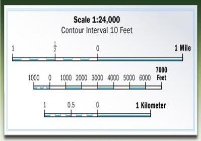
Respuesta
-
Line Scale
-
Representative Fraction Scale
-
Direct Statement Scale
-
Ratio Scale
Pregunta 41
Pregunta
If a Representative Fraction Scale is expressed as 1:50,000. What is the Direct Statement Scale?
Respuesta
-
1 cm = .5 km
-
1 cm = 5 km
-
1 cm = 50 km
-
5 cm = .1 km
Pregunta 42
Pregunta
If 1 cm on a map equals 2.5 km on the Earth, or 1 cm = 2.5 km, what is the Representative Fraction Scale?
Respuesta
-
1:250,000
-
1:25,000
-
1:2,500
-
1:2,500,000
Pregunta 43
Pregunta
How many time zones are there?
Respuesta
-
14
-
24
-
180
-
360
Pregunta 44
Pregunta
Approximately, using degrees, how far apart are each time zone?
Respuesta
-
15 degrees
-
360 degrees
-
24 degrees
-
90 degrees
Pregunta 45
Pregunta
How many time zones does Canada have?
Respuesta
-
6
-
4
-
5
-
7
Pregunta 46
Pregunta
Who introduced the idea of standard time?
Respuesta
-
Sir Sandford Fleming
-
John A. MacDonald
-
Louis Riel
-
John Guest
Pregunta 47
Respuesta
-
Are ahead of Universal Time (UT)
-
Are behind Universal Time (UT)
-
Are a day ahead of Universal Time (UT)
-
Are a day behind Universal Time (UT)
Pregunta 48
Respuesta
-
Are ahead of UT
-
Are behind UT
-
Are a day ahead of UT
-
Are a day behind UT
Pregunta 49
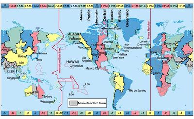
Respuesta
-
You add a day
-
You lose a day
-
You are one hour ahead of UT
-
You are one hour behind UT
Pregunta 50
Pregunta
If you cross the International Date Line move eastward
Respuesta
-
You add a day
-
You lose a day
-
You are one hour ahead of UT
-
You are one hour behind UT
¿Quieres crear tus propios Tests gratis con GoConqr? Más información.