
Mapa mental
DME Navigation System
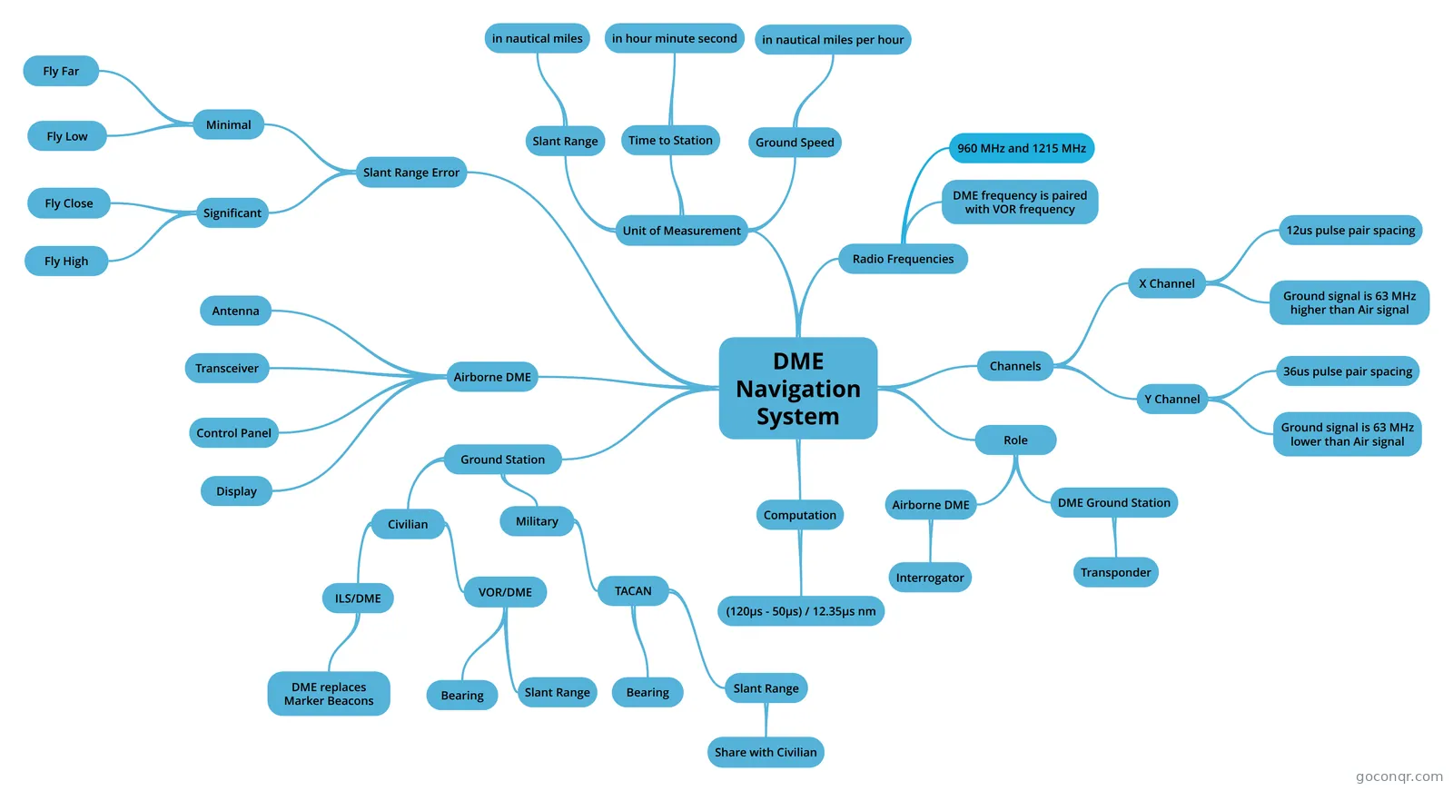
Mind map: DME navigation system
Conteúdo do mapa
DME Navigation System
Role
- Airborne DME
- Interrogator
- DME Ground Station
- Transponder
- Airborne DME
Unit of Measurement
- Slant Range
- in nautical miles
- Time to Station
- in hour minute second
- Ground Speed
- in nautical miles per hour
- Slant Range
Airborne DME
- Control Panel
- Transceiver
- Antenna
- Display
Channels
- X Channel
- 12us pulse pair spacing
- Ground signal is 63 MHz higher than Air signal
- Y Channel
- 36us pulse pair spacing
- Ground signal is 63 MHz lower than Air signal
- X Channel
Radio Frequencies
- 960 MHz and 1215 MHz
- DME frequency is paired with VOR frequency
Slant Range Error
- Minimal
- Fly Far
- Fly Low
- Significant
- Fly Close
- Fly High
- Minimal
Computation
- (120µs - 50µs) / 12.35µs nm
Ground Station
- Civilian
- VOR/DME
- Slant Range
- Bearing
- ILS/DME
- DME replaces Marker Beacons
- VOR/DME
- Military
- TACAN
- Slant Range
- Share with Civilian
- Bearing
- Slant Range
- TACAN
- Civilian
Informações
- Descrição
- For measuring slant distance
- Criado por
- KIM SENG TANG
- Visualizações
- 164
- Tags
- Avaliação